

 Street Scene, Urumqi
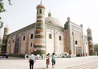 Abakh Khoja Mausoleum
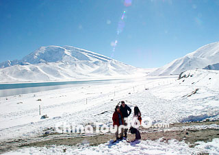 Karakoram Lake, Kashgar
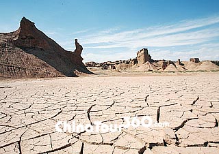 Ghost City, Kuqa
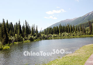 Kanas Lake, Altay
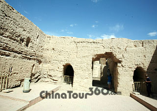 Jiaohe Ancient Town
Xinjiang was founded as an autonomous region in Northwest China on October 1, 1955. Xinjiang, Uygur Autonomous Region, lauded variously as a land of song and dance, melons and fruits, precious stones, and carpets, is situated in the heart of the Eurasia Continent. It was a key link on the Silk Road and a center for east-west cultural exchanges during ancient times.
With 20 million people living here, Xinjiang Uygur Autonomous Region is the largest administrative area in the country, covering an area of more than 1,660,000 square kilometers (640,930 square miles), which accounts for 1/6 of the national land area. It is divided into two basins by Mount Tianshan. Dzungarian Basin is in the north, and Tarim Basin is in the south. Xinjiang also has the longest boundary among China's provinces and autonomous regions and shares 5,600 kilometers (3,480 miles) of frontier with Mongolia in the northeast, then Russia, Kazakhstan, Kyrgyzstan and Tajikistan in the west, and then Afghanistan, Pakistan and India in the southwest. It is home to a number of different distinct ethnic groups, many of them Turkic, the largest of which is the Uyghur people.
While Xinjiang enjoys between 2,500 to 3,000 hours of sunshine each year, the amount of annual precipitation for the entire region averages a mere 150 milliliters (9.2 cubic inches), and thus the air is quite dry. Situated deep in the interior of Asia and not penetrated by the air currents from the oceans, the Xinjiang Uygur Autonomous Region has a conspicuous continental climate, with a highly changeable temperature, great difference in temperature between day and night, abundant sunshine and intense evaporation.
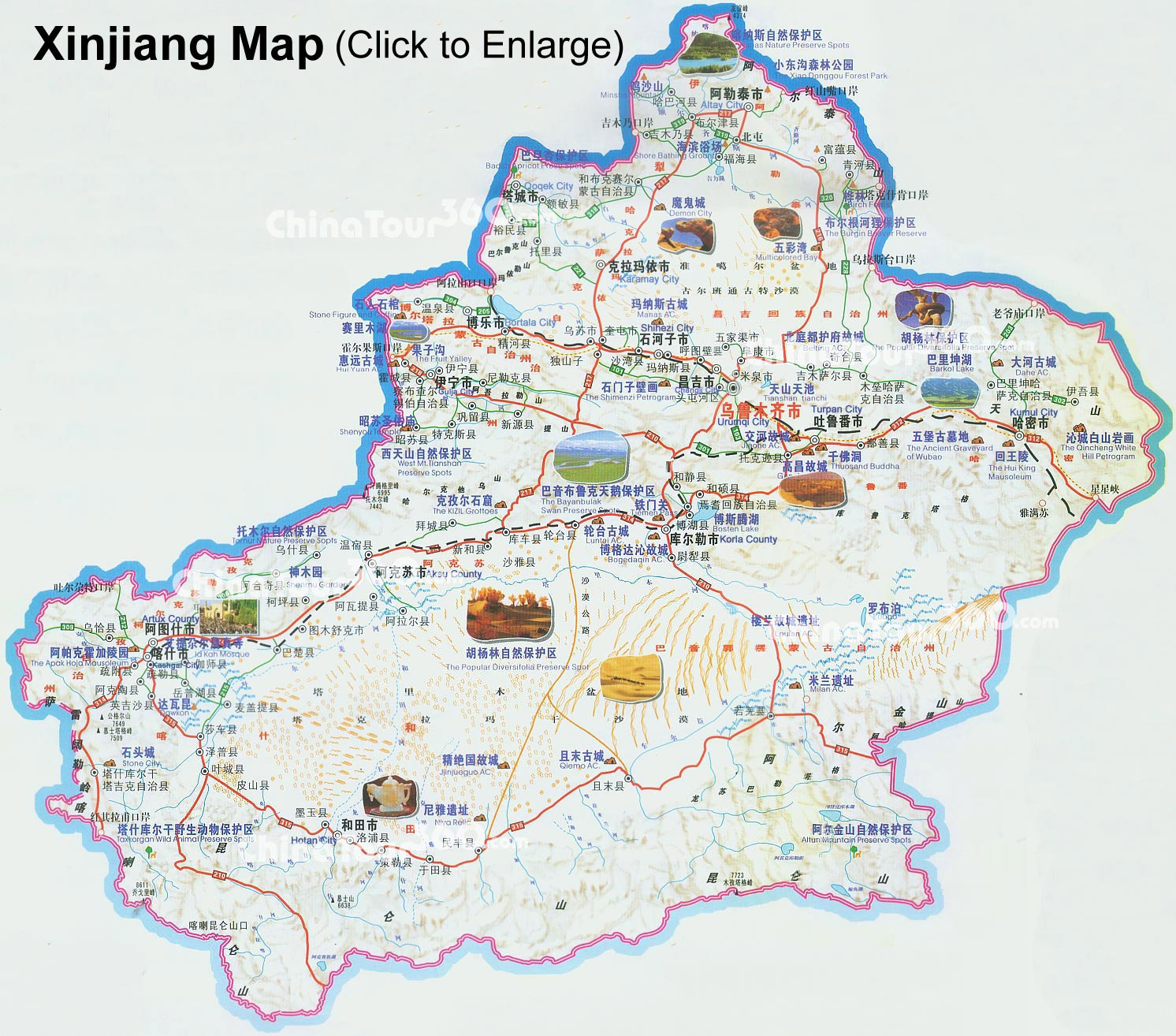 |
| Xinjiang Tourist Map |
Xinjiang boasts rich and diverse tourist resources. Landscapes here are both unique and beautiful. Tourists are attracted by wild landscapes and particular combination of natural sights. Here, you can see snow-capped mountains stand in very hot land, and deserts neighbor on oases. Superlatives are often used when describing Xinjiang: It is the most arid, hottest, and coldest place; contains China's longest inland river, the Tarim; the lowest marsh, the Aydingkol Lake (Moonlight Lake) in the Turpan Basin; the lowest land and greatest desert as well. Here the tourist can see a most spectacular and engrossing topography of the world, locally known as 'Yardang' and enjoy the mystery of the desert with its spectacular sand mountains.
Standing on the Silk Road, Xinjiang is famous for being dominated by deserts, mountains, stunning lakes, green grasslands, and its various ethnic groups with their unique costumes. The region's history is long, complex and written accounts vary depending on the perspective of the historians. Although remote and desolate, it is a truly wonderful place retaining an air of purity, mystery and adventure.
![]() Recommended Urumqi Tour Itineraries:
Recommended Urumqi Tour Itineraries:
China Silk Road Tour: 14-Day of Beijing - Urumqi - Kashgar - Urumqi - Turpan - Dunhuang - Xian - Shanghai
Silk Road Adventure Tour: 22-Day of Beijing - Urumqi - Korla - Kuqa - Aksu - Kashgar - Hetian - Minfeng - Korla - Turpan - Dunhuang - Xian - Shanghai