

 Relics of Wei State Wall
 Wei State Wall, Warring States
![]() Warring States Period, Qin Dynasty, Han Dynasty, and Ming Dynasty Great Walls
Warring States Period, Qin Dynasty, Han Dynasty, and Ming Dynasty Great Walls
As early as in the 7th century BC, the Chu State of the Warring States Period (476 - 221BC) built Fangcheng, the earliest Great Wall, as a defense against the northern nomadic tribes, enemies and other potential threats. For the same purpose, the Qi, Yan, Wei, Zhao, Qin and Zhongshan States also built their own walls successively. The walls built at that time were either rammed with earth or built with stones, and natural barriers themselves, such as mountain ridges and steep cliffs, were integrated into the wall directly. Some warning and defensive facilities were also built along the walls, including pavilions, beacon towers and obstacles.
![]() Great Wall of the Chu State
Great Wall of the Chu State
To control the whole of China and to guard against attacks from the Jin and Qi states, the Chu State built many defensive castles at their northern border, and then connected them with mountain ridges, river banks and walls. As a result, a rectangular defensive system named Fangcheng or Wancheng formed, which was the earliest wall of China. Fangcheng was later continuously enlarged and strengthened to oppose assault sfrom the other states especially from the strong Qin State. Finally, the Wall of Chu State started from northeastern Dengzhou City of Henan Province, spread north to the Yiwangshan Mountain, turned to the east, along the Funiushan Mountain, via southern Lushan County to western Yexian County, turned southeast, ending at Zhongyang Mountain, with a total length of 500 li (155 miles).
![]() Qi State
Qi State
In the early Warring States Period, the Qi State was at its peak, but the neighboring Lu State was decaying. The Chu and Yue States took advantage of the situation to occupy the Lu State. Later, the Chu State continuously dispatched military expeditions to the north, wiped out the Zhu, Qi and Ju States, and drove the Yue State out of the lands of the original Lu State. Under direct threat from the Chu State, the Qi State built the eastern wall. In the middle Warring States Period, the Chu State eliminated the Yue State, which put the Qi State in greater danger. Thus, the Qi State built the middle wall, renovated the eastern wall, and joined them together. The final Qi State Great Wall, historically named Qian Li Chang Cheng (a-thousand-li Great Wall), lied across the middle part of present-day Shandong Province, and totaled 618.9 km (385 miles). It started from the present northern Guangli Village under Changqing County on the eastern bank of the Yellow River, turned eastward to the hilly areas, wound up to the western slope of the Taishan Mountain, went along the watershed of the Tai-Yi Mountains, and reached the west coast of the Yellow Sea.
![]() Yan State
Yan State
Located between the present-day northern Hebei Province and western Liaoning Province, the Yan State bordered the Qi and Zhao States to the south, and neighbored the nomadic tribes to the north. To defend against attack from the neighboring states, the Yan State built two sections of wall: the northern and the southern wall. According to scientific investigation, the Yan State Wall extended from the Xuanhua District of Zhangjiakou City in the west, bent to northeast until entering Duolun County of Inner Mongolia, moved east after crossing though northern Weichang County in Hebei Province, passed Aohan Banner (a county-level administrative district) below Chifeng City in Inner Mongolia, entered Chaoyang City of Liaoning Province, wound though Yiwulu Mountain and the Liaohe River, turned south, and reached the northern bank of the Qingchuan River, North Korea.
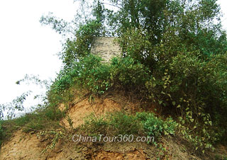
![]() Wei State
Wei State
Having being defeated by the Qin State many times, the Wei State was forced to move its capital to Daliang (the present Kaifeng City in Henan Province) from the original Anyi City (the present Xiaxian County of Shanxi Province), and built their walls on the western and southern banks of the Yellow River to protect the capital city and territory from being invaded by the Qin State. Wei State Wall on the western bank of the Yellow River, also named 'Binluo Great Wall', measured over 100 km (62 miles). It began from the entrance of the Huashan Mountain Valley, went down along the Changjian River, via Gucheng Village in northwestern Huayin County, crossed the Weihe River, went ashore northeast of the Binluo Town of Pucheng County, passed though Dali County, and entered Chengcheng County, further to the north to Heyin County, and reached the bank of the Yellow River through Hancheng City. The starting point of the wall on the southern bank of the Yellow River was approximately in the present northeastern Yuanyang County of Henan Province, spread towards the east first and then southwest to present-day Zhengzhou City, and ended at Mixian County.
![]() Zhao State
Zhao State
To defend its border security, Zhao State also built two walls: one was in present-day Cixian and Linzhang counties in Hebei Province, and the other was further divided into northern and southern sections. The northern section was from the gap between the Wula and Langshan Mountains in Inner Mongolia, winding its way towards the east along the southern slope of the Yinshan Mountain, via the northern parts of Wuyuan and Guyang counties, and stopping at the northern slope of the Daqingshan Mountain in Hohhot City. The southern section started from Urat Front Banner of Inner Mongolia on the eastern bank of the Yellow River, went east along the southern slope of the Daqingshan Mountain, passed through the northern areas of Baotou and Hohhot cities, as well as Zhuozi County, turned south to Chahar Youyi Qianqi, Ulanqab, Inner Mongolia.
![]() Qin State
Qin State
Being an economically backward state and having frequent internal troubles, the Qin State suffered continuous attacks from the Wei State in the early Warring States Period. Thus, the Qin State built walls on the western bank of the Yellow and Luoshui Rivers successively. This section of the wall originated from Xiaozhang Village at the Huanshan Mountain, then spread northeast through the northeast part of Huayin Temple, crossed the Shaqu River to the bank of the Weihe River, continued its course along the southern bank of the Luohe River, turned west until it reached Pucheng County, moved its way to the north along the western bank of the Luohe River, and finally ended at the Huanglong Mountain in Baishui County. The Qin State also built another wall later at its northwestern border to defend against the Yiqu Tribe which was a branch of the Xirong, an ancient nomadic people of Western China. It wound its way from Gansu, via southern Ningxia, went back to Gansu again, and then spread to northern Shaanxi, passing by southern Inner Mongolia, and reaching the western bank of the Yellow River in the end.
![]() Zhongshan State
Zhongshan State
A small kingdom between the Zhao and Yan States, Zhongshan State in the present Hebei Province was always a serious hidden danger for the Zhao State, and was invaded by it many times. To guard against these frequent attacks from the Zhao State, Zhongshan State built a wall. Through years of investigation and excavation, relics of the Zhongshan State Wall have been discovered in Laiyuan, Tangxian, Shunping and Quyang counties of Hebei Province.